Showing posts with label C2C. Show all posts

Saturday, 4 June 2016

Coast to Coast Walk

I have just finished walking the Coast-to-Coast route from St Bees in Cumbria to Robin’s Hood’s Bay in Yorkshire.
It’s described as one of the top 10 long-distance walks in the world, just over 190 miles and first suggested by Alfred Wainwright, the man who mapped so many routes in the Lake District.
It doesn’t sound spectacular compared to the Tour de Mont Blanc or Camino de Santiago, but I guess what makes it special is that you have a sense of travelling through a landscape; it’s not all mountains or all coastline, the countryside changes from the rugged Lake District, through the Westmoreland Plateau, into the limestone of the peaty Pennines, down Swaledale from high valley to gentle countryside, across the Vale of Mowbray to the bogs of the North York Moors and on to a coast walk into Robin Hood’s Bay.
There are changes of agriculture, there are changes of fauna and the three areas of high land in the national parks are all very different.
It’s often quite tough walking, made all the more difficult this year because of the severe floods which hit Cumbria and Yorkshire last winter. This has caused a number of landslips, but has also washed out many paths and left others resembling dry stream beds. Where there were steps and a level surface underfoot, there’s now nothing but the bigger boulders – very hard on the feet!
Navigation is also a challenge. The route is poorly signposted throughout. In many parts, there are no signs and, in other places, signs are inconsistent and unreliable. You need a map with the route marked on and a good guide book. In the Lake District, if the weather closes in, you may need a compass. I think you’ll also need the moral support of a companion. You could always make friends en route, but I walked it with my near neighbour, David Jones.
We used Discovery Travel to book our accommodation, The Pack Horse delivered our bags to each B&B in turn and for navigation we had Harvey's special Coast-to-Coast maps, which have the route marked and split the walk into sections across two maps; also Trailblazer's Coast-to-Coast Path book, which has lots of information and also many detailed, sketch maps.
Neither is entirely sufficient - the maps in the book are somewhat too detailed and often hard to fathom, while Harvey's maps are a little small in scale and need more detail. The ideal would be an OS Landranger with the route drawn on, but I had the next best thing. I subscribe to the OS on-line service at £18 per year and they provide a free smartphone app which allows you to read maps on your phone and pinpoint your exact position using GPS. You can also insert your own routes and I found a .gpx file with all waypoints marked that I was able to import. This meant that when we were in doubt about our route or position, we could refer to the app for revision or re-assurance. It was very useful.
Poor waymarking and poor paths were an irritation. The Coast-to-Coast walk attracts thousands of people from all over the world and is vital for the economy of a wide corridor through northern England and yet it has not been designated as an official long-distance path. It should be given official status and it should have money invested on improving paths and on proper, consistent waymarking.
What did I enjoy most about the walk? The scenery was stunning, it was a challenge, I liked the variation, I loved the wildflowers and I saw lots of interesting birds.

Coast to Coast walk - arrival at St Bees

Pebbles selected and ready for the off!
The walk starts from St Bees in Cumbria, a small town or a large village (take your pick) named after St Bega, a Irish princess and early Christian who established a religious community there some time between 500 and 800 CE.
Joyce and Margaret drove us up, dropped us off by our B&B and disappeared south; we set off to explore St Bees. There's an ancient sandstone Norman church with an interesting carved stone doorway. It was once part of a Benedictine priory, dissolved during Henry VIII's land grab. From the church, we headed into town looking for somewhere to eat that night. It was a strange place - on a Friday afternoon at around 4pm, everyone seemed to have stopped work and headed for the pub. Every pub seemed packed and quite rowdy and none of them looked particularly appetising.
At the coast, we found the start of our walk for the next day and selected a couple of pebbles from the beach. There's a tradition that people doing the walk get their boots wet in the Irish Sea and pick up a pebble which they carry to Robin Hood's Bay and throw into the sea before wetting their boots in the North Sea. David chose a surprisingly small pebble (perhaps trying to cut down on weight).
There's a large display plaque depicting the start of the route and you can see the path climbing the cliff to the north.
That evening, we ate at the Seatoller Hotel, a large place by the sea that has seen better days. The large bar had a strong smell of damp, so we went into the lounge, which was not too bad and had a couple of beers and a light meal. The clientele seemed to comprise construction workers, several couples not quite enjoying the dirty weekend they imagined and a few walkers. The beer was Black Sheep and it was pretty good.
When we came out into the early evening light the Isle of Man was crystal clear on the horizon. It looked magical.

Coast to Coast - Day One

Day One: St Bees to Ennderdale (14 miles)
David seems to have brought a lot of stuff. He has a large case, carefully packed by Joyce, which will become harder and harder to close as David's packing and repacking displaces its contents, also a large day pack, which is also full and rather heavy (I now understood the need for a very small pebble). When he was strapping on gaiters after breakfast, I wondered if I had packed too light.
This is where it all starts - the beach at St Bees
First job was to wet our boots, but we'd only gone 100 yards when I put my hand in my pocket and found the key to the B&B. Thank goodness I found it there and not at Ennerdale! After that false start, it was a straight to the sea for a paddle and then the first steps on our journey.
Unfortunately, those first steps are steeply uphill. A gentle stroll along the shore would have helped my breakfast go down, but we soon realised that Wainwright loved nothing more than a steep, uphill climb, unless it was an even steeper descent. If that man saw a hill, he had to climb it.
David and I had done a few training walks around the village, In Rutland and Norfolk and we have a similar pace, but we had not done any serious hill-climbing because there are no serious hills to climb. I found that David walks uphill slightly faster than me, so the trick is to get in front and set the pace if it's a steep climb.
The coast is quite stunning with steep cliffs and lots of nesting birds packed onto ledges. We'd been going a couple of miles when we were passed on the coast path by a man and woman, who we were later to get to know much better, called Karen and Jess. That first section along the coast took much longer than expected which was the story of the walk. A couple of miles around Toneham takes 40 minutes, but on the walk, we'd see a sign saying one mile to a particular point and after half an hour we might see it in the distance. Cumbria and (especially) Yorkshire miles seem twice the length of Cambridgeshire miles.
The path eventually turns inland through a couple of villages and then along an old railway track for a couple of miles. We found old railway tracks a little haven of easy walking later in the journey and this one allowed us to put on some distance with minimal effort. As we approached the first village (Sandwith) we were passed by two men and a woman, who were steaming on. As we came around a bend, I found a pair of gloves on the road obviously dropped by the woman. They were just about in earshot and she came jogging back. It turns out they were walking the C2C for the fourth time having already done it twice west to east and once east to west.
David is good with a map. His life as a farmer seems to have given him an appreciation of the countryside and he manages to get his bearings better than I do. We successfully navigated our first bog and ate some lunch at the church in Cleator sat in a little cloister on a stone slab. David went to his pack and pulled out a couple of foam pads to sit on - he is well prepared! We'd got a packed lunch from our first landlady and it was clear we were not going to manage to eat it all. I have found before that on a long day's walking, all I want in the middle is an energy bar or a biscuit and some fluids. Four rounds of ham salad sandwiches is too much.
The landlady at St Bees had told us there was a single woman called Juliet who would be completing the walk that day from east to west and so we spent the whole day looking (in vain) for Juliet.
David at the top of Dent Hill
After Cleator, we had our first major climb of the walk. At 344m, Dent Hill is not much of a challenge, but everyone talked about it. I enjoyed the walk up - a long, even climb with the views opening out around us. We had a good view of the sea, Isle of Man, the nuclear plant at Windscale and the Lakeland fells where we would be walking for the next few days. Frustratingly, after five hours walking, St Bees still seemed only a stone's throw away. On top of Dent Hill, we met two Liverpudlian women in their early 50s, who were doing the walk.
If the walk up Dent Hill had been comfortable, the walk down at the side of Raven Crag into the steep valley of Nannycatch Beck was less so. It is very steep and there's no clear path. Thankfully, the weather was dry and sunny; in the rain it would be a nightmare. David's right knee was hurting. He'd tweaked it on the walk down into Cleator before lunch and it was now troubling him badly. He had insisted on bringing his favourite walking stick with him, a beautiful long, heavy wooden stick with a twisted wood handle and brass tip. It's great for carrying around the farm, but (in my view) too heavy and unbalancing for long-distance walks. I lent him my poles for the descent and we made it down OK, but an injury like that was a worry on day one of the walk.
The last four miles into Ennerdale are an easy walk along the side of Nannycatch Beck and then alongside a minor road for a while. I stopped to talk to a woman with an old springer spaniel. She was providing some support to her son and daughter-in-law, who were doing the walk but camping and carrying (hardcore). She and her husband had a camper van and were providing the odd tent-free night for them. She was quite anxious that they hadn't passed two footsore old men as they were "very good walkers" and we left her worrying like only a mother can. Half a mile down the road, dad was sitting on a bench. "They'll turn up soon," he said.
In Ennerdale, the first building we came to was a new cafe that had opened only a few weeks earlier. We had been heading for the pub, but we decided a cup of tea would be better. The cafe would not have been out of place in Shoreditch, with more types of fancy tea than you could imagine and no tea-bags allowed. Teapots with a little pouch for loose tea were delivered (slowly) to your table and each came with a set of fancy sand-glasses which you turned over as the tea arrived. There were three timers, for weak, medium or strong. I'd have liked a spoon to give it all a good stir! Infusion needs agitation in my book.
That night we were staying at Rowrah Hall, about three miles from Ennerdale and the arrangement was that we'd call from Ennerdale and be picked up. Our landlady (Maggie) arrived in a Jaguar estate and we gave the two Liverpool girls a lift to Rowrah where they were also staying (in the Swan). Rowrah Hall was a lovely place and Maggie (another Liverpudlian) was living the good life - she kept hens, bees, grew her own veg and made her own cakes, biscuits and granola. Our accommodation was self-contained at the side of the main building and comprised a lounge and kitchen downstairs and bedroom plus bathroom upstairs. It was probably our best B&B of the trip. That night, at Maggie's recommendation, we ate at The Hound Inn (prawn salad) and downed a few pints of Black Sheep.
Rowrah Hall - possibly the best B&B of the trip


Coast to Coast - Day Two

Day Two: Ennerdale to Stonethwaite (16 miles)
First injury of the tour: I
break my tooth on a biscuit
This was our first day of walking in the Lake District (proper) and involves a climb of over 600 metres to a pass at Grey Knotts, which takes us from Ennerdale into Borrowdale.
There's the option of a high-level route over Red Pike and High Stile, but we had decided to stick to the easier track and, on the advice of Maggie, our landlady, we also took the slightly longer, but easier, north shore of Ennerdale Water on account of David's knee, which was troubling him.
The day began with a drive back to Ennerdale. Maggie's husband did the honours in another Jaguar and it turns out he's a policeman specialising in armed response. You wouldn't think Cumbria needed armed police, but of course, there was an incident in 2010 when taxi driver Derrick Bird went on the rampage with a shotgun and killed 12 people plus 11 more injured. Maggie's husband hadn't been on duty that day, but remembered it well and gave us a run-down of what happened, including lots of lucky escapes.
It was another beautiful day in the Lakes and the walk around Ennerdale Water was not without a climb and scramble, but was certainly easier than the southern path. It also meant we got to see Crag Fell and Robin Hood's Chair. Where the two paths joined, we met a lone woman hiker looking a little perplexed and I wondered if it was Juliet, still trying to find her way to St Bees.
Not Juliet, but Sue. We never did find Juliet.
We offered the help of our combined navigational skills and it turns out the woman was called Sue, she was from Australia and she was walking the coast to coast on her own. She joined up with us for the rest of the day and we spent the next nine days walking with her as far as the North York Moors.
The valley path takes you on a good track to a youth hostel called Black Sail Hut near the head of Ennderdale. From there, you can see a path that goes steeply up the head of the valley and over the top via Windy Gap. Sam and I walked that route maybe 18 years ago. We'd been up to Wasdale to climb Scafell Pike and the following day we were going to go up Great Gable but the cloudbase was too low and it was rather windy, so we decided to climb up to Styhead Tarn and then up the path (Windy Gap) between Great Gable and Green Gable, around the back of Great Gable and then down again into Wasdale. It was a steep old climb and I almost turned off down the path we could now see, which would have taken us into Ennerdale. Luckily, Sam proved a better navigator and we stayed high before dropping down into the right valley behind Kirk Fell.
Well Windy Gap was not for us this day, but we did have a steep climb to the north alongside Loft Beck and up to the side of Grey Knotts. Before that, however, disaster struck! We were eating lunch at the Black Sail and Maggie had provided us with some homemade biscuits. As I bit into it, I felt my tooth move. Quickly, I disengaged my gnashers but it was too late, my poor tooth (an old bridge) was hanging loose and I pulled it off and popped it into a little plastic bag supplied by Sue. So now I had no choice but to complete the walk either looking like a complete chav or not smiling - it had to be a front tooth didn't it!
David and I at Black Sail Hut
After Black Sail Hut, the route is indistinct and boggy in places, although spring has been quite dry after the rains of December, so we weren't in danger of going over our boots. It's a hard, rocky ascent and then a more pleasant walk across the top of the pass alongside Grey Knotts before dropping down into Borrowdale, via Honister. The views of Haystacks and down to Buttermere were good and, because it was a Sunday, there were quite a few people about. Heading north, we hit the course of the old tramway from the Honister Slate Mine and followed that down to the visitor centre (it's now a tourist attraction). It was already late afternoon, so we had tea and cake in the cafe before heading off to Stonethwaite where we'd stay for the night.
David had found the descent very tough and his knee was hurting, but we still had some way to go. The rest of the walk was downhill and easier. It's amazing how quickly the landscape softens and becomes more lush as you lose height; it's also amazing how long and hard those last few miles feel each day.
Our accommodation was in Stonethwaite, which is a mile further on than Rosthwaite (the standard destination for stage two), so with our extended walk around the lake and this extra mile, we'd probably clocked up 18 miles today. We found our landlady for the night sitting in the early evening sun in her front garden, so we said hello and then went to the village pub, The Langstrath, for medicinal alcohol. It turns out that Sue can down a gin and tonic like a suckling lamb. Sue was also staying in our B&B and we arranged to meet for dinner at the pub later. I wished we were staying at The Langstrath as our B&B was a bit more basic. The Langstrath was built in 1590 as a row of miners cottages and has been extended and altered over the years. Food was good and we met up again with Karen and Jess, who had passed us on the first day. They are good fun. Karen is in her forties and determined to stay fit; Jess is fit, but is quite a big chap and has a voice not unlike comedian Johnny Vegas.
There was a group of young people in the pub, who were very drunk. I got talking to one in the gents and he said they were from Workington and had been swimming in Stonethwaite Beck. Apparently, there are waterfalls and pools further up and he got his phone out (one handed) to show me the pictures. Nothing interrupts the flow of urine like looking at pictures on a stranger's smartphone. The only thing that spoiled their day was there was no Jagermeister in the pub for Jager bombs.
I'd like to go back to Stonethwaite one day ...

Coast to Coast - Day Three

Day three: Stonethwaite to Grasmere (nine miles)
On the walk out of Borrowdale
It's indicative of how we are getting into this walking lark that we now consider a nine-mile walk and 2,000ft of climb to be an easy day. David's knee is a worry, but he has delved into his supplies and found an elastic knee bandage and a tube of Voltarol gel which acts as a painkiller by absorbing paracetamol through the skin. I discovered that Joyce had also packed a survival bag, but only one. In the unlikely event that we are lost in a blizzard, I might have to stage an unfortunate accident to acquire David's survival bag.
This might be only nine miles, but with washed out paths and a steep ascent, it is hard work and I developed blisters underneath both my big toes. We walked alongside the beck for a while and then struck up at the head of the valley to Greenup Edge past Eagle Crag and Sergeant's Crag to our right. It was great to hear a number of cuckoos on our climb; I haven't heard a cuckoo for years.
Pausing for breath near the top of Greenup Edge. We didn't know Karen was taking our picture.
Karen and Jess passed us on the way up and sat at the top taking pictures of us puffing up. We also met two girls in their mid-30s, who I guessed were German, but they informed me (rather indignantly) that they were Netherlanders. They were navigating mainly by means of the Trailblazer Coast to Coast book and were getting along very well.
At the top of Greenup Edge there's a flat boggy bit and first the path and then the cairns disappear. We kept heading more or less in the right general direction but came to the descent a little too far north and had to traverse the slope to reach Flour Gill (a small marker stream) and then over into Easdale. There was a higher-level alternative taking in Calf Crag, Gibson Knott and Helm Crag, but we kept to the valley. I would have quite liked the high route today. My first trip to the Lake District was with a school trip when I was about 14. We visited Grasmere and climbed Helm Crag.
Sue is good company and a good walker. She's done a crazy traverse of New Guinea (short but very tough) and did the Camino de Santiago last year (also alone). She was a nurse in recovery (where people come round after operations) and her husband Richard is a cattle farmer and runs an engineering business. They live in Adelaide, which is, apparently, the non-convict area of Australia.
She surprised us by announcing, totally out of the blue, that wombat shit is a perfect cube, like a pile of dice. It was a rather strange thing to say, but we had been spending a lot of the walk trying not to step in sheep shit! We said if Sue wanted to walk with us, she would have to tell us an interesting fact about wombats every day.
It was a lovely warm, sunny afternoon when we reached Grasmere and it was strange to be in such as busy place after three days on the fells with relatively few people about. We sat and had a cup of tea, looking down our noses at the day walkers all kitted out with fancy poles and clean boots. My toes were blistered and I was less than chuffed to find that our B&B was a mile the other side of Grasmere. We had to walk out there, walk back in for food that night, back to bed and then back into Grasmere in the morning to meet Sue. Ha! What's four miles when you're walking 190?
Sue and David in Borrowdale


Coast to Coast - Day Four

Day four: Grasmere to Patterdale (nine miles)
Grasmere with Helm Crag in the background. I climbed
that at school on my first trip to the Lake District
Our landlady in Grasmere had an annoying husband. He had a mate or knew someone who had run the route we were about to take and had done it in 20 minutes. He'd also been up at 6am and had a swim in Grasmere that morning.
To help my blistered toes, David gave me Compeed patches from his store of supplies. They are funny things and look like blisters themselves. The idea is that you stick them onto your blister and they protect it from further rubbing. They seemed quite good, they meant I could get my boot on without too much discomfort and I bought a box in Grasmere to see me through the rest of the walk. David bought himself a walking pole. I tried to persuade him to buy two and throw his heavy stick into the hedge, but he wouldn't have it.
The lovely sunny weather we'd enjoyed for the past three days had disappeared this morning and it was cloudy but quite warm. From Grasmere we headed up Grizedale Pass (another steep climb, but not as harsh as the haul up to Greenup Edge). It was a good path for a change, but once we got to about 1,500 feet, we walked into the cloud and it was quite wetting.
Above and below: on the way up to the Grizedale Pass through the murk

At the top, there was a strong wind blowing and it was so misty we couldn't even see Grizedale Tarn until we were right up to the shore. It was pointless doing either of the high-level alternatives (Helvellyn or St Sunday Crag) and so we stuck to Grizedale itself. We walked down out of the cloud at Ruthwaite Lodge (a climbers' hut) to find a bloke taking a pee up the side of the building. He just carried on peeing, no apology, no explanation ... nothing but pee. Sue and I walked around the other side to be out of the wind and the sight of pee, while this chap struck up a conversation with David.
He was wittering on about walking there and climbing that when he suddenly said he'd had a bit of bad news - he'd just heard his friend had died. I started giggling and set Sue off, so while David was expressing his condolences around the other side of the building, we were splitting our sides.

David at Ruthwaite Lodge, chatting to
his new friend
On the route down to Patterdale, in the clearing weather, I was able to pick out Striding Edge and see the path that Tom and I took when we walked it some 20 years ago. There was lots of evidence of the very severe floods they had back in December including chunks of hillside washed away, walls gone and lower fields strewn with rubble like the terminal moraine of a disappeared glacier.
Amid the rubble and destruction, there were lovely blue wild violets in the gaps between slabs of stones on the path, also bluebells in the trees and wild garlic in any shady spot lower than 1,500ft.
Today's wombat fact was a little disappointing - wombats live in burrows. Come on Sue, you can do better than that!
In Patterdale, we conveniently arrived in the car park of the Patterdale Hotel and it was warm and sunny enough to sit on the front lawn and have a cup of tea. David and I were staying at Grizedale Lodge, while Sue had to walk on to Glenridding, a village particularly badly hit by the winter floods. We arranged to meet next morning at the top of the road leading to Grizedale Lodge, where we were staying. As we arrived, our landlady was just returning on her racing bike and the Sherpa Van arrived with our bags - suddenly Patterdale was a very busy place. The B&B was very good. They hadn't been troubled by the floods there, but another place they owned had been flooded. She said they'd had loads of help from volunteers and the authorities, who had provided free skips and other practical assistance. She did say that Glenridding had been very badly affected.
Damage caused by the winter's floods
My toes were quite sore. When I looked, my blisters had burst and so had the Compeed patches and pulling them off brought off some skin as well. Another blister had formed, full of bloody puss and that also burst as the Compeed patch came off. Ah - the joys of walking! I bound them with tissues and bandage tape and set off for the pub.
We were planning to eat that night in the White Lion, which is about half a mile down the road. We sat with Karen and Jess and the two Dutch girls were also in there, plus the Liverpudlians from the first day. I think we were on Jennings (brewed near Workington) that night rather than Black Sheep.
Looking up Patterdale towards Grizedale Pass

Coast to Coast - Day Five

Day Five: Patterdale to Shap (16 miles)
The path out of Patterdale
This (for me) was the hardest day of the walk. It's not that long, but there's over 4,000 feet of ascent, including Kidsty Piky, which at just over 2,500 feet, is the highest point on the Coast to Coast unless you do the Helvellyn variant. After Kidsty Pike, there's a knee-crunching descent to Haweswater and just as you expect a nice walk around the lake, you discover it's an up-and-down scramble. Actually, the day is full of nasty surprises - at the end of Haweswater, the map seems to show a gentle, grassy path across rolling fields to Shap. The path actually winds annoyingly, there are uncountable wobbly stiles to cross and the waymarking is very poor.
The first part of the walk, out of Patterdale, was pleasant enough, a steep but steady pull uphill with a few crucial decisions to make regarding which path to take. Thanks to David's homing instinct and the two Dutch girls, we managed to get most of them right (or realise we were wrong very quickly).
The first landmark is Angle Tarn and as we approached it we could hear some strange noises like dogs barking and yelping. As we got up to the tarn, it was obvious they were geese (possibly Canada geese) making a right din. The path drops a little and then climbs again up to The Knott at 732m. On the way up, we were musing about a fork in the path. I thought we should stick close to a dry stone wall, but the more obvious path seemed to go left. I was joined by another walker, who said "this must be it" and set off on the left-hand path. He was walking the coast to coast and so I followed him. We gained height quite quickly and then the path petered out and I could see the two Dutch girls below sticking to the wall, where there was now a clear path.
There was nothing for it but to scramble down. The chap was called Tim and he was doing the walk with his younger nephew. I'd have put him about mid-50s, he was tall, grey and quite rangy. We both agreed that we hated going wrong, especially when it meant you'd climbed up, only to go down. His nephew, who was some way behind, had stuck to the wall.
Where, exactly are we? Checking book (above), also map and app (below)

We were told in the book and by our landlady that the next turn was tricky. At a place called Riggindale Straits, there was a sharp turn, almost back on yourself, towards Rampsgill Head and Kidsty Pike. It looked obvious on the map and we were looking out for it, but still missed it. We knew we were wrong, but couldn't see how. Instead of a path to the left, there was a sharp drop. Then I saw some people on the ridge to our left and realised that's where we should be. The two Dutch girls were already walking back and found the path by a small cairn. It was obvious walking back, but well hidden from our original direction. Tim and his nephew had thrust on ahead and were out of earshot, heading for High Street. As we scrambled back onto the ridge path, we saw them look back, see us and turn around. I made a mental note never to follow Tim.
The next section of walk was lovely. A long, climbing ridge ending with the small peak of Kidsty Pike at the end, with wonderful views east across Haweswater. At Kidsty, there was a group of friends - us, Sue, the Liverpudlian girls, the Dutch girls, Tim and his nephew. Nine miles to the east (as the crow flies) I could see the white scar of Hardendale limestone quarry, which sits between the A6 and M6 just south of Shap. That's where we still had to walk to.
On top of Kidsty Pike, the highest point on the Coast to Coast
The descent to Haweswater is steep and long. It was just the treatment David's knee did not need. Despite lashings of Voltarol, a support bandage and the new pole, he was still struggling on the downward sections. We took it slow and steady and reached the shore after a long scramble and a break for lunch on the way down.
The long scramble down to Haweswater
Sue offered us her daily wombat fact: when threatened by a predator, the wombat blocks the entrance to his burrow with his fat body, a bit like the fat bloke on the tube who won't move away from the doors to let other people on.
We were pre-warned about the path around Haweswater (now a reservoir feeding Manchester). It was long, the path was rocky and it involved a number of small climbs and steep descents. It also started raining intermittently. By the time we got to Burnbanks, the model village built at the end of the lake, I was tired and footsore. I was looking forward to a few gentle miles  (about five) into Shap.
When I'm weary, I try to visualise distance into a concept I can understand, so I'd told myself that all I had to do was walk around Knarr Fen Road and Toneham. God, if only it had been that easy. The path was unclear, badly marked, stiles were wobbly and the path wound frustratingly. Every mile seemed double the distance.
One of the frustrations of the coast to coast walk to our schedule is that it left little or no time for serendipity. We generally had to be somewhere and generally had to keep walking. Shap Abbey, another one ticked off Henry VIII's list, was founded by a small order of French monks, known as the White Canons. It was the last abbey to be founded in Britain and the last to be seized by Henry. It would have been worth an hour looking round the ruins, but we were tired and keen to get to our lodgings. As you approach the site, there's a very old and wonderful arching, stone footbridge across Swindale Beck which must have been built by the monks. Tim and his nephew were sitting at the foot enjoying a drink and snack. Someone had left a plastic container full of goodies and an honesty box.
It was still a mile or so to the abbey ruins and then we found civilisation in the form of a road and another old stone bridge across the River Lowther. There were fish swimming in the clear, fast-flowing water under the bridge and a couple of people fish watching. David struck up conversation with the man, who told us it was only just over a mile into Shap. David had thought we were there and I think he considered chucking the man over the edge when he heard the news. If that wasn't bad enough, the chap then told us that our accommodation - the King's Arms - was right at the end of the village and probably yet another mile.
By the time, we got to the pub I was so tired I could not think. Earlier, I had been practising counting in Spanish, but couldn't get the numbers in the right order, then (along Haweswater) I realised I couldn't remember the registration number of my car and I still hadn't got it five miles later. Instead of going straight up to our room, we sat in the beer garden and had a couple of pints of Black Sheep, which restored us wonderfully. It's KS06 ZSP, I remembered.
The King's Arms was a welcome sight, but it's not a fine pub. It's one of those places with peeling paint on the outside and dead plants in the tubs. The food is convenience, the service surly and there was no chance of porridge for breakfast. I had Weetabix instead. The evening meal was good.
We sat with the Dutch girls, who are called Saskia and Lysa. David asked how they knew each other and when they said they were "in a relationship" he thought at first they meant “related”. They were in their mid 30s (but look much younger) and were doing just the first half of the walk as they had to be back for work. I teased them about Andre Rieu and they said he was not a nice man, not that famous in the Netherlands and "from the Catholic part" of the country, which seems to be a big insult if you’re Dutch. Kate and Jess also joined us and it turned out that they were also walking only as far as Kirkby Stephen, so this would be our last night with them. We found that Jess was having his 50th this year and that he had been a diver in the Royal Navy, specialising in bomb disposal. He now works as a marine consultant. I got the impression they hadn't been together that long and Kate has children from a previous relationship. The two Liverpool girls (one now lives in Colorado and the other in Nottingham) were having a small party as some of their relatives had come up to spend the night with them. Liverpool were losing in the final of the UEFA Cup, which took the shine off for at least one of the party. It was also the last time we'd see them. Although they were doing the whole walk, they were having a short day tomorrow and also a rest day in Richmond. We'd finish a couple of days ahead of them.
Our party, which had become very comfortable and familiar, was breaking up.

Coast to Coast - Day Six

Day Six: Shap to Kirkby Stephen (21 miles).
Looking back to the Lakeland Fells from the Westmoreland plataeu
After the hardest day of the walk so far, what you need is a nice short leg. No such luck - we had a 21-mile slog across the Westmoreland plateau and Eden Valley. The Liverpool girls were walking just eight miles to the village of Orton - how I envied them.
Although long, the route contains no major challenges and it was an opportunity for recovery from sore knees and blisters. David has no blisters and as soon as he feels a tender spot, he slaps a Compeed over it. That's clearly the way to do it; I think I left it too late and my blisters were already too well developed by the time I used Compeed. Anyway, I've donated the pack I bought to David and he is supplying me with big patches of plaster, which I'm using to protect the burst blisters under my toes from shredding any further. I'm securing the plasters with bandage tape and it's working pretty well.
If I were doing the walk with the knowledge I now have, I'd make it a three-week project and allow more time for diversions and sightseeing. Today was a good example. There was limestone pavement, prehistoric circles and burial mounds, views to the Pennines and back to the Lakeland Fells, birds to hear and see ... but no time to explore.
We set off early and soon crossed our first major marker - the M6 motorway, which seemed excessively hurried and busy to our walk-tuned minds. Crossing the country off the beaten track makes it seem very strange and busy when you enter a town or encounter something like the M6.
Our wombat fact of the day was the collective noun for these creatures. Apparently, it's a wisdom of wombats. Sue may have made that up, but it was the best wombat fact so far!
I was well weary by the time we reached Kirkby Stephen, which is the largest town we've yet encountered and a busy little place full of guesthouses, pubs, restaurants and a railway station. Sue's B&B was on the way into town and her landlady was outside when we arrived. She recommended the Black Bull for a meal and we arranged to meet there later. Our accommodation was in the town centre, so we had a little further to walk, but we found it easily enough. Landlady Barbara White was fantastic, she greeted us with tea and crumpets and nothing was too much trouble. I asked if Kirkby Stephen was in Yorkshire and she told me it was in the old county of Westmoreland, sadly no longer is existence having been combined with Cumberland into the new area called Cumbria. Barbara has done the coast to coast walk herself.

The Black Bull was good - more Black Sheep - and we also discovered it was quiz night, so after eating, we put together a team called Coasters International, comprising David and I, Sue and the two Dutch girls. We made a storming start thanks to a round on London where I knew all the answers, Saskia and Lysa kept us in the game with their knowledge of pop music, but then we came unstuck on British No1 records and ended up third. It was good fun and our last night with Saskia and Lysa, who were back to the Netherlands in the morning.

Coast to Coast - Day Seven

Day Seven: Kirkby Stephen to Keld (13 miles)
This is a significant day. Keld, our destination, marks the halfway point in the Coast to Coast and, today, we also cross into Yorkshire. The interesting geographic fact is that we also cross the watershed of the Pennines, which means all the rivers now flow west to east.
The weather has generally been brilliant, but rain was forecast today and I realised that I didn't have any waterproof pants. Margaret had re-proofed my walking trousers and hung them in the wardrobe in the spare room so I would know where they were. That is Margaret's logic. My logic is that they'd be in the bag in the hall where they always are. Anyway, despite being told they were in the wardrobe in the spare room, I had forgotten to pack them, so first port of call was a walking shop to buy a pair.
Barbara seems to know everyone in Kirkby Stephen and said we should visit this chap who had a little outdoor shop opposite the Black Bull. He was a nice man but had been struggling because Mountain Warehouse, or another of the big chains, had opened a large shop further down and now everyone went there.
Barbara's PR campaign seemed to be working because his little shop was packed, but he sorted me out very quickly. David was being troubled by blisters, not on his feet, but on his hand (from holding that heavy great stick) so he bought a pair of gloves. I persuaded him to spend £30 on a pair of Sealskins. They are the gloves I have and they are fantastic, but I don't think David got on that well with them. My suggestion that the stick be recycled as firewood and David treat himself to some lightweight, balanced poles, was met with scorn.
I was sorry to leave Kirkby Stephen. I'd been pleased to see it yesterday and it had treated me very well.
The coast walk is signposted in the town and there's a somewhat depressing sign to remind you that, in spite of six days hard walking, you've still not reached halfway! From KS, the path follows a minor road steeply uphill towards the day's big climb - Nine Standards Rigg. This is a pretty standard ridge and, at 662 metres, not unduly high. What makes it interesting, almost mystical, are the nine high cairns carefully built on the crest and visible for miles. They have been there for hundreds (possibly thousands) of years and not a lot is known about them. It was thought that they were markers built by a dark ages chieftain to define his territory, but now there's evidence (see link: http://www.ninestandards.eu/final%20report.html) that they date back to the Bronze Age and may be burial cairns thousands of years old. There have been as many as 13 cairns, there's evidence of a ditch enclosure and the cairns have been rebuilt many times over the years, most recently in 2005. In the 18th century local shepherds pulled two of them down and used the stones to build themselves a hut. They were ordered to restore the cairns, but I don't think they did a great job since they managed to keep their hut intact.
Nine Standards Rigg.
Whatever their origin, it's an amazing place, really atmospheric and with fantastic views across the Eden Valley, over the Westmoreland Plateau towards the fells of Cumbria. East, you can pick out the main Yorkshire peaks, including Ingleborough and the other great whalebacks of the Pennines.
Path erosion on the way up to Nine
Standards Rigg
On the path up to Nine Standards, heavy rain and heavy footfall have seriously eroded the path and there are a number of projects to raise funds to pave the path up to the ridge and then onwards across the peat bog. Putting paving across moorland is always controversial, but I feel there's no alternative and I'm sure it will be thoughtfully undertaken. The first target has been reached and now, hopefully, a further sum will be raised for the second phase. You can find out more on: http://www.crowdfunder.co.uk/raisingthestandard
The walk up to the ridge becomes steeper and as we neared the top the rain came in, so there was a quick stop for putting on my new waterproof pants and my jacket. Annoyingly, I managed to put my bag down in a pile of sheep shit! As we were dressing, a man and a woman came striding past at a good pace. She was stripped to T-shirt and was working hard with her poles. "A good work-out," she said as she strode past, making me feel as if I wasn't trying hard enough.
On the top, we took some pictures, admired the view and spotted Tim and his nephew. They were striding off across the moors, stopped and then changed direction to follow the ridge-line - another wrong turn! The couple who has passed us were also off along the ridge and we spotted some new walkers - two men, one of whom was rather chubby and was holding a plastic supermarket bag. We learned later that they'd set off carrying all their gear, but had found it hard going and so had hired Sherpa Van to take it on for them. One chap had a day-sack on his front and rucksack on his back, so he just swapped the day-sack over. Chubby man had no day-sack to carry his gear, so he popped into the supermarket and begged a 5p carrier. It wasn't the image I'd have wanted to project on this epic walk.
From the Nine Standards, the path divides to try to reduce erosion. There's a May-July path and an Aug-Nov path. Earlier, there's a Dec-April path, which doesn't climb the ridge and uses part of the B6270 to stay at a lower level. This being May, we took the May-to-July path. The rain had blown over, leaving it sunny but windy. David led the way across the peat bog. It had been a relatively dry spring, but even so, we had to pick our way carefully in places. The depth of peat is amazing, it must be four metres in places and there are tales of walkers sinking up to their waists.
There are few guides to your route as a lot of the marker poles have fallen (it's amazing this important tourist route and money-earner isn't better maintained). Thanks to David's instinct and my OS app, we managed to stay on the right route, but Tim and his nephew had gone wrong again and were now heading for the road.
The path drops down into Whitsundale where more streams combine to form the larger stream that becomes the River Swale. There are grouse butts alongside the path and, in places, the path is made more difficult by the wheeltracks of the gamekeepers' 4x4s. This is true of many of the bridleways in this part of the world. No-one walks if they can ride. I saw several shepherds whizzing by on quads, a collie sitting in the back with its ears streaming in the wind.
Grouse shooting is big business and in August this would be a noisy place, full of rich merchant bankers who pay a fortune to shoot the red grouse out of the sky. The grouse are ridiculously tame and are not truly wild birds at all. Gamekeepers come to feed them, they will whistle and the grouse come flying in from all around for their dinner. David says there have been several articles in Farmers Weekly about grouse numbers falling and laying the blame on global warming. David thought lead poisoning might be a bigger killer.
Even the bleak moors are not without their celebrities and the home of one - Amanda Owen, known as the Yorkshire Shepherdess - lies alongside the path. Amanda's story is either a modern romance or a string of poor life decisions. As a young woman, she came to Ravenseat farm to pick up a sheep and found a husband more than 20 years her senior. Twenty years later she has eight children (and another on the way as I write). She's now a standard bearer for the traditional (hard) Dales way of life, author of books, a regular on TV and runs a cafe for walkers (when she's about).
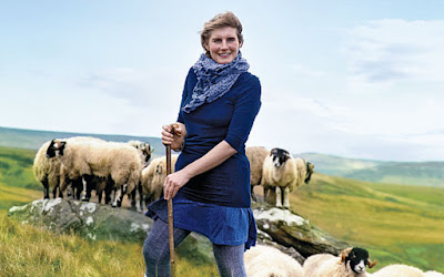
Ravenseat is in a lovely location, set in a cleft where there's an ancient bridge across Whitsundale Beck. On this sunny but windy day, it looked idyllic (less so, I suspect, on a bleak December afternoon). We had tea on one of the picnic benches at the front of the farm, served, I am guessing, by Amanda's oldest daughter. If you're interested in reading more, see: http://www.telegraph.co.uk/women/mother-tongue/11043837/Reader-I-married-him-confessions-of-a-Yorkshire-shepherdess.html. She also has a book and a calendar.
Amanda Owen - the Yorkshire Shepherdess
We had been hoping for a good wombat fact after yesterday's triumph, but when we prompted Sue over lunch, she simply said she didn't have any more, she'd run out! Has she never heard of Google?
From Ravenseat, the path follows the growing stream. There are a number of small waterfalls, known here by the Viking word "force". Soon you reach the road (the B6270) and enter Keld. This is the halfway point on the Coast to Coast, but it's a tiny place. We stayed at Butt House, a guesthouse now run by a nice couple from Wellingborough, who sell beer (Black Sheep) and wine to guests and will also cook an evening meal. Sue was at the pub (the Keld Lodge) just up the road and we wandered up there for a drink (Black Sheep). The place was full of Australians. A coast-to-coast party of five Aussies had arrived from Kirkby Stephen. We hadn't seen them on the walk because they'd taken the low route along the road. Sue said they were from the convict part and weren't very friendly. They were all of retirement age and were spending a couple of months in Europe. One of the party - a retired engineer originally from New Zealand - looked as if he'd suffered a minor stroke, but was getting along at a fair lick. His wife told me that when they'd finished the walk, they were going to spend some time in London with their daughter.
Before dinner I walked down into the few houses which comprise the village to find a post box. I'd written a postcard for Margaret. The times on the front suggested I'd just missed the collection, but I put it in anyway and I was staggered to hear it was delivered the next day. From one of the most remote villages in England at 6pm to Thorney by 10am the next day is pretty good going. Some bits of this country still work quite well!
For dinner at Butt House we all sat around a large table. After the familiarity of our party during the first week, it was odd to have so many strangers and I regarded them with suspicion, a little like the seasoned soldier views new recruits. I sat next to a woman who had just retired and was walking the Pennine Way (which crosses the Coast to Coast at Keld), there was a couple with a house in Hampshire and a house in London (let's call them Two Homes and a Porsche) and the couple who had gone striding past us on the climb to Nine Standards Rigg. They were Canadian and were a brother-in-law/sister-in-law combination, a really nice couple called Paul and Susan. It was Susan's first long-distance walk.
Two Homes were accomplished walkers, but there was nowhere they hadn't been: Himalayas, tick; African safari, tick; combined with Kilimanjaro, tick ... They explained they bought their flat in London because Mr Two Homes had got so many points on his licence driving in every day. "Of course, when you drive a Porsche, speeding fines are inevitable," he said.
They were like a red rag to a bull for David.